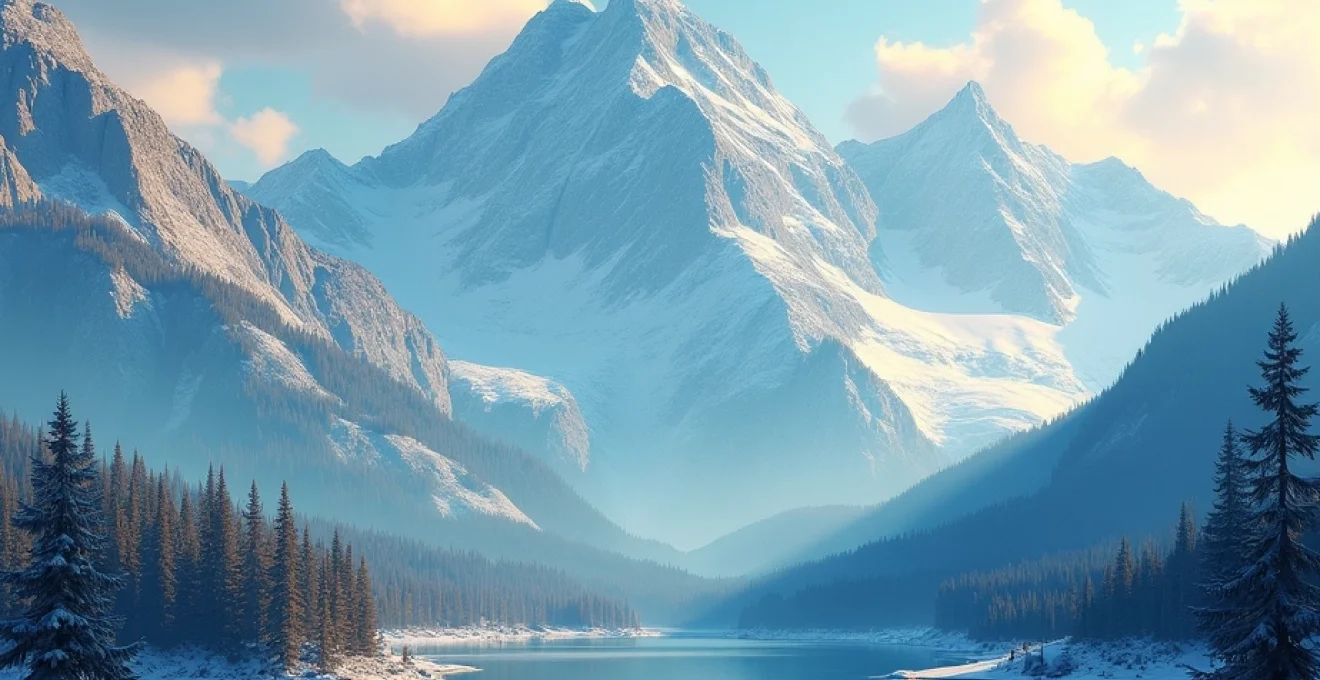
The Canadian Rockies represent one of Earth’s most remarkable wilderness sanctuaries, where towering peaks pierce the sky and pristine ecosystems flourish in dramatic alpine environments. This UNESCO World Heritage Site encompasses over 20,000 square kilometers of protected wilderness across Alberta and British Columbia, creating an unparalleled destination for those seeking authentic connections with nature. From the turquoise waters of Lake Louise to the ancient glaciers of the Columbia Icefield, these mountains offer extraordinary biodiversity, challenging terrain, and cultural significance that continues to captivate scientists, adventurers, and conservationists from around the globe.
Biodiversity hotspots and endemic species distribution in the canadian rockies ecosystem
The Canadian Rockies support remarkable species diversity across multiple elevation zones, creating distinct ecological niches that harbor both common and rare wildlife populations. Montane, subalpine, and alpine ecosystems each contribute unique assemblages of flora and fauna, with over 1,000 vascular plant species and 280 bird species documented throughout the region. The complex topography generates microclimates that allow species typically found hundreds of kilometers apart to coexist within relatively small areas, making these mountains a living laboratory for ecological research.
Recent biodiversity assessments reveal that climate change is shifting species distributions upward along mountain slopes, with treeline advancing at an average rate of 2.3 meters per decade. This phenomenon creates both opportunities and challenges for wildlife management, as some species benefit from expanded habitat while others face habitat compression at higher elevations. Research stations throughout Banff and Jasper National Parks continuously monitor these changes, providing crucial data for conservation planning and ecosystem management strategies.
Alpine flora conservation in banff and jasper national parks
Alpine plant communities in the Canadian Rockies exhibit extraordinary adaptations to harsh mountain environments, with many species displaying cushion growth forms, deep taproot systems, and specialized cold-tolerance mechanisms. Endemic species such as the Banff Springs snail ( Physella johnsoni ) and several rare alpine wildflowers require specific conservation approaches due to their limited distributions and sensitivity to environmental changes. The Parks Canada Species at Risk program actively monitors 45 listed species within these protected areas, implementing targeted recovery strategies for the most vulnerable populations.
Botanical surveys conducted between 2018 and 2023 documented significant range shifts among alpine flora, with warm-adapted species advancing upward while cold-adapted species retreated to increasingly isolated refugia. Conservation efforts focus on protecting critical habitat corridors and reducing human impacts in sensitive alpine zones through seasonal closures and visitor education programs.
Grizzly bear population dynamics and habitat corridors
The Canadian Rockies support one of North America’s most viable grizzly bear populations, with current estimates indicating approximately 65 bears within Banff National Park and 109 bears in Jasper National Park. These populations face ongoing challenges from habitat fragmentation caused by transportation corridors, particularly the Trans-Canada Highway and Canadian Pacific Railway, which create barriers to movement and increase mortality rates through vehicle strikes.
Wildlife crossing structures, including 44 overpasses and underpasses along the Trans-Canada Highway, have reduced wildlife-vehicle collisions by over 80% since their implementation, while facilitating crucial genetic exchange between bear populations on either side of the highway.
Recent GPS collar studies reveal that female grizzly bears with cubs utilize home ranges averaging 150 square kilometers, significantly larger than previously estimated. This research demonstrates the critical importance of maintaining large, connected habitat blocks and informs land-use planning decisions both within and adjacent to protected areas.
Mountain goat migration patterns along the continental divide
Mountain goats exhibit unique movement patterns along the Continental Divide, with populations demonstrating seasonal migrations between summer foraging areas and winter refugia. Advanced GPS collar technology has revealed migration routes extending up to 40 kilometers, with goats traversing extremely rugged terrain to access critical mineral licks and escape deep snow accumulations. These movements often cross park boundaries, highlighting the need for coordinated conservation efforts across jurisdictional lines.
Population surveys conducted using helicopter-based counting methods indicate stable goat numbers throughout most of the Canadian Rockies, with approximately 3,200 individuals across all mountain parks. However, localized declines in heavily visited areas suggest that human disturbance may be affecting habitat use patterns, particularly during the sensitive kidding season from May through July.
Rare bird species monitoring in kananaskis country
Kananaskis Country serves as a crucial monitoring site for numerous rare bird species, including the white-tailed ptarmigan, golden eagle, and several warbler species at the northern edge of their ranges. The Alberta Breeding Bird Atlas project has documented 178 species breeding within this region, with citizen science contributions providing valuable long-term data on population trends and habitat associations.
Climate-driven range shifts are particularly evident among high-elevation specialists, with American pipit and gray-crowned rosy-finch populations showing upward elevational movements averaging 127 meters over the past three decades. Monitoring protocols established in 1995 continue to track these changes, providing essential baseline data for climate adaptation planning.
Aquatic ecosystem health in bow river and athabasca river systems
The Bow and Athabasca River systems originating in the Canadian Rockies support diverse aquatic communities, including native bull trout, mountain whitefish, and Arctic grayling populations. Water quality monitoring reveals generally excellent conditions throughout headwater areas, though increasing recreational pressure and climate-related changes present emerging challenges for aquatic ecosystem management.
Invasive species management efforts focus on preventing the establishment of non-native fish species and aquatic invertebrates that could disrupt native food webs. Education programs targeting anglers and recreational boaters emphasize the importance of cleaning equipment between water bodies and reporting unusual species sightings to prevent further introductions.
Technical mountaineering routes and peak classification systems
The Canadian Rockies offer some of North America’s most challenging and rewarding technical climbing experiences, with route difficulty classifications ranging from basic scrambles to extremely technical multi-day ascents requiring advanced mountaineering skills. The standardized grading system employed throughout the region helps climbers assess route difficulty, commitment level, and required equipment, ensuring safer mountain experiences and more accurate trip planning capabilities.
Peak classification systems developed by the Alpine Club of Canada categorize over 400 named summits exceeding 3,000 meters in elevation, with detailed route descriptions, historical ascent records, and current condition reports available through digital platforms. Technical climbing infrastructure continues to evolve with improved bolting standards, rescue cache placements, and GPS waypoint accuracy, enhancing both safety and accessibility for qualified mountaineers.
Grade VI technical climbing on mount assiniboine’s north face
Mount Assiniboine’s North Face represents the pinnacle of technical climbing achievement in the Canadian Rockies, featuring a 1,500-meter route graded at 5.7 A2 Grade VI. This demanding ascent requires multiple bivouacs, advanced aid climbing techniques, and exceptional weather judgment due to the face’s exposure to prevailing storm systems. First ascended in 1967, the route has seen fewer than 50 successful completions, making it one of the most exclusive climbing objectives in the range.
Modern ascent strategies typically involve establishing advanced base camps at the 2,600-meter level, allowing climbing teams to monitor weather windows and retreat efficiently if conditions deteriorate. Route conditions vary significantly based on seasonal factors, with optimal climbing windows generally occurring between mid-July and early September when rockfall hazards are minimized and daylight hours remain sufficient for safe descent.
Via ferrata infrastructure development in mount norquay
The Mount Norquay Via Ferrata system represents innovative infrastructure development that provides controlled exposure to technical mountain terrain while maintaining high safety standards. This engineered route features steel cable systems, iron rungs, and suspension bridges that allow participants to experience dramatic cliff exposure with minimal technical climbing experience. The installation process required extensive environmental impact assessment and specialized construction techniques adapted to alpine conditions.
Operational data from the first three seasons indicates high satisfaction rates among participants and minimal environmental impact when proper group size limits are maintained. The success of this project has generated interest in similar developments throughout the region, though careful site selection and environmental assessment remain paramount considerations for future installations.
Avalanche risk assessment protocols for mount columbia ascents
Mount Columbia, the highest peak in Alberta at 3,747 meters, presents significant avalanche hazards throughout most ascent routes, requiring sophisticated risk assessment and mitigation strategies. The standard route via the Saskatchewan Glacier involves travel across numerous avalanche paths, with hazard ratings fluctuating based on snowpack stability, weather patterns, and temperature trends. Professional guide services utilize standardized risk assessment matrices that incorporate real-time avalanche bulletins, weather forecasts, and snowpack observations.
Recent improvements in avalanche forecasting accuracy have reduced incidents by 60% over the past decade, though the inherent dangers of high-altitude mountaineering in avalanche terrain demand constant vigilance and conservative decision-making processes.
Training requirements for Mount Columbia ascents include formal avalanche education certification, rescue technique proficiency, and demonstrated experience on similar technical objectives. Pre-trip planning sessions review escape routes, communication protocols, and emergency response procedures specific to the remote location and challenging access conditions.
Alpine start logistics for mount robson’s emperor face
The Emperor Face of Mount Robson demands exceptional logistical planning due to its remote location, technical difficulty, and unpredictable weather patterns. Alpine start timing becomes critical for this Grade VI route, with most successful ascents beginning between 2:00 and 4:00 AM to maximize climbing time before afternoon weather deterioration. The approach involves a 23-kilometer trek to base camp, followed by technical climbing through mixed rock, snow, and ice conditions.
Gear selection for Emperor Face ascents requires balancing weight considerations with safety margins, typically including specialized high-altitude equipment, advanced rescue gear, and redundant navigation systems. Success rates hover around 30% due to weather windows, route conditions, and the extreme technical demands placed on climbing teams throughout the multi-day ascent process.
Backcountry navigation technologies and wilderness safety protocols
Modern backcountry navigation in the Canadian Rockies integrates traditional compass and map skills with advanced GPS technology, satellite communication devices, and weather monitoring systems. The challenging terrain, rapidly changing weather conditions, and vast wilderness areas demand comprehensive navigation competency and redundant safety systems. Digital mapping platforms now provide real-time trail conditions, weather updates, and emergency communication capabilities that significantly enhance backcountry safety when properly utilized.
Wilderness safety protocols have evolved substantially with technological advances, though fundamental principles of risk assessment, emergency preparedness, and self-rescue capabilities remain paramount. Recent statistics indicate that proper navigation equipment and training reduce wilderness emergencies by approximately 70%, while satellite communication devices have decreased average rescue response times from 8 hours to under 3 hours in remote areas. Training programs emphasizing both traditional and modern navigation techniques ensure that backcountry travelers maintain essential skills even when electronic devices fail or batteries are depleted.
Advanced weather monitoring systems accessible through smartphone applications provide unprecedented accuracy in forecasting mountain weather patterns, with precipitation and wind speed predictions now reliable within 6-hour windows. However, the complex topography of the Canadian Rockies creates localized weather phenomena that can differ dramatically from regional forecasts, requiring travelers to develop observational skills and conservative decision-making approaches when conditions appear uncertain or potentially dangerous.
Geological formation analysis and paleontological significance
The geological complexity of the Canadian Rockies reveals a fascinating history spanning over 500 million years, with sedimentary rock layers recording ancient marine environments, tectonic upheavals, and climatic changes that shaped the modern landscape. These mountains formed through the collision of tectonic plates during the Laramide Orogeny, creating the dramatic thrust faulting and folding visible throughout the region today. Paleontological discoveries continue to provide insights into prehistoric life forms and environmental conditions that existed long before the current alpine ecosystems developed.
Recent advances in geological dating techniques have refined understanding of mountain-building processes, revealing that peak uplift occurred between 80 and 55 million years ago, followed by extensive erosion and glacial sculpting during multiple ice ages. The interplay between geological processes and climate change creates ongoing landscape evolution that influences ecosystem development, hydrological patterns, and natural hazard distributions throughout the region.
Burgess shale fossil discovery sites and research methodologies
The Burgess Shale fossil beds represent one of the world’s most significant paleontological treasures, preserving exceptional detail of Cambrian-period life forms that existed 505 million years ago. Located within Yoho National Park, these UNESCO World Heritage fossil sites contain over 65,000 specimens representing more than 200 species, many of which provide crucial insights into early animal evolution and diversification during the Cambrian explosion.
Current research methodologies employ advanced imaging techniques, including CT scanning and electron microscopy, to reveal internal anatomical structures previously invisible in these ancient specimens. Strict access controls and specialized collection techniques ensure continued preservation while allowing scientific research to proceed under carefully monitored conditions. The Royal Ontario Museum and University of Toronto continue leading research efforts, with new species discoveries occurring annually despite over a century of intensive study.
Sedimentary rock stratification in the canadian shield transition zone
The transition zone between the Canadian Shield and Rocky Mountain formations reveals complex geological relationships that help explain regional landscape development and mineral resource distributions. Sedimentary rock sequences exhibit clear stratification patterns that record changing depositional environments, from shallow marine conditions to terrestrial formations, providing a detailed geological timeline spanning hundreds of millions of years.
Field research techniques utilized in these formations include detailed stratigraphic mapping, geochemical analysis, and structural geology investigations that reveal the complex deformation history experienced during mountain building. These studies contribute to broader understanding of North American geological evolution and inform mineral exploration activities in adjacent regions.
Glacial erosion patterns and U-Shaped valley formation
Glacial erosion processes have fundamentally shaped the dramatic valley systems characteristic of the Canadian Rockies, creating the distinctive U-shaped profiles visible throughout the region. During multiple ice ages, massive glaciers carved through existing river valleys, widening and deepening them while creating the hanging valleys, cirques, and arêtes that define the modern landscape. Contemporary glacial retreat allows detailed study of erosional processes and provides insights into future landscape evolution under changing climatic conditions.
Glacial mapping studies indicate that ice coverage was approximately 85% greater during the Last Glacial Maximum compared to current conditions, with ice thickness exceeding 1,000 meters in major valley systems such as the Bow and Athabasca valleys.
Modern research techniques including LiDAR mapping, ground-penetrating radar, and GPS-based monitoring systems provide unprecedented detail about ongoing glacial processes and landscape change rates. This research proves essential for understanding climate change impacts and predicting future hydrological changes that will affect downstream communities and ecosystems.
Karst topography development in maligne canyon systems
The Maligne Canyon system demonstrates classic karst topography development in limestone bedrock, creating spectacular gorges, underground drainage networks, and cave systems through chemical weathering processes. Water flowing through fractures in limestone bedrock gradually dissolves the rock, creating the narrow canyon walls and complex underground drainage patterns visible today. These geological processes continue actively, with measurable canyon deepening occurring over human timescales.
Hydrological studies of karst systems reveal complex groundwater flow patterns that influence surface water availability and ecosystem development. Understanding these processes proves crucial for water resource management and helps explain the seasonal variations in stream flow that characterize many Rocky Mountain watersheds throughout the region.
Advanced photography techniques for rocky mountain landscapes
Capturing the majestic beauty of the Canadian Rockies requires mastery of specialized photography techniques adapted to challenging mountain environments and dramatic lighting conditions. Alpine photography demands understanding of high-altitude atmospheric effects, rapidly changing weather patterns, and extreme temperature variations that affect both equipment performance and image quality. Professional landscape photographers working in these environments typically employ graduated neutral density filters, polarizing filters, and specialized cold-weather gear to achieve consistently excellent results.
Advanced composition techniques specific to mountain photography include utilizing foreground elements such as alpine lakes or wildflower meadows to create depth and scale, timing shots to capture optimal lighting conditions during golden hour periods, and employing focus stacking methods to achieve sharp detail throughout complex three-dimensional scenes. The unique qualities of mountain light, including enhanced contrast ratios and increased ultraviolet radiation at elevation, require careful exposure management and often benefit from bracketed exposure sequences processed using HDR techniques.
Modern digital photography equipment performs exceptionally well in Rocky Mountain environments when properly protected from moisture, temperature extremes, and physical impacts common during backcountry travel. Battery performance decreases significantly in cold conditions, requiring photographers to carry multiple spare batteries and employ insulation strategies to maintain equipment functionality at optimal levels. Mirrorless camera systems offer advantages in weight reduction and battery efficiency, making them increasingly popular choices for extended backcountry photography expeditions requiring minimal gear loads.
Indigenous cultural heritage sites and traditional ecological knowledge systems
The Canadian Rockies have served as home and sacred territory for Indigenous peoples for over 10,000 years, with archaeological evidence revealing complex cultural relationships between First Nations communities and these mountain landscapes. Traditional ecological knowledge systems developed by the Stoney Nakoda, Blackfoot, Cree, and other Indigenous nations provide profound insights into sustainable resource management, seasonal patterns, and wildlife behavior that continue to inform modern conservation approaches. Sacred sites throughout the region maintain deep spiritual significance and require respectful recognition within contemporary land management frameworks.
Cultural landscape mapping projects conducted in partnership with Indigenous communities have identified over 200 significant archaeological sites within the mountain parks, including ancient hunting camps, spiritual ceremonial locations, and traditional travel routes that connected diverse tribal territories. These discoveries reveal sophisticated knowledge systems that enabled Indigenous peoples to thrive in challenging mountain environments for millennia, developing sustainable hunting practices, seasonal migration patterns, and resource management strategies that maintained ecological balance.
Modern collaboration between Indigenous knowledge keepers and Parks Canada scientists has enhanced understanding of climate change impacts, wildlife population dynamics, and ecosystem management approaches. Traditional fire management practices, medicinal plant harvesting protocols, and seasonal timing observations provide valuable perspectives that complement scientific research methods and contribute to more holistic conservation strategies throughout the region.
Elder knowledge holders from the Treaty 7 nations continue sharing traditional stories, place names, and ecological wisdom that reveals the deep interconnectedness between Indigenous cultures and Rocky Mountain ecosystems, emphasizing stewardship responsibilities that extend far beyond contemporary park boundaries.
Contemporary Indigenous tourism initiatives create opportunities for visitors to learn about traditional cultures while supporting community economic development and cultural preservation efforts. These programs include guided interpretive walks, traditional craft demonstrations, storytelling sessions, and cultural protocols education that foster greater understanding and respect for Indigenous perspectives on land relationship and environmental stewardship. Revenue generated through these initiatives directly supports cultural preservation programs and provides employment opportunities within Indigenous communities adjacent to the mountain parks.
Language revitalization efforts focus on preserving traditional place names and ecological terminology that encode detailed environmental knowledge developed over countless generations. Digital archiving projects document elder interviews, traditional stories, and ecological observations in Indigenous languages, ensuring this irreplaceable knowledge remains accessible for future generations while supporting ongoing research collaboration between Indigenous communities and academic institutions.
The integration of traditional ecological knowledge with contemporary scientific research continues revealing new insights about ecosystem functioning, species relationships, and environmental change patterns throughout the Canadian Rockies. This collaborative approach demonstrates that combining Indigenous wisdom with modern research methods creates more comprehensive understanding of these complex mountain environments and supports more effective long-term conservation strategies that honor both cultural heritage and ecological integrity.